
Politics
Hurricane Polo Strengthens As Pacific Coast Braces For Major Storm
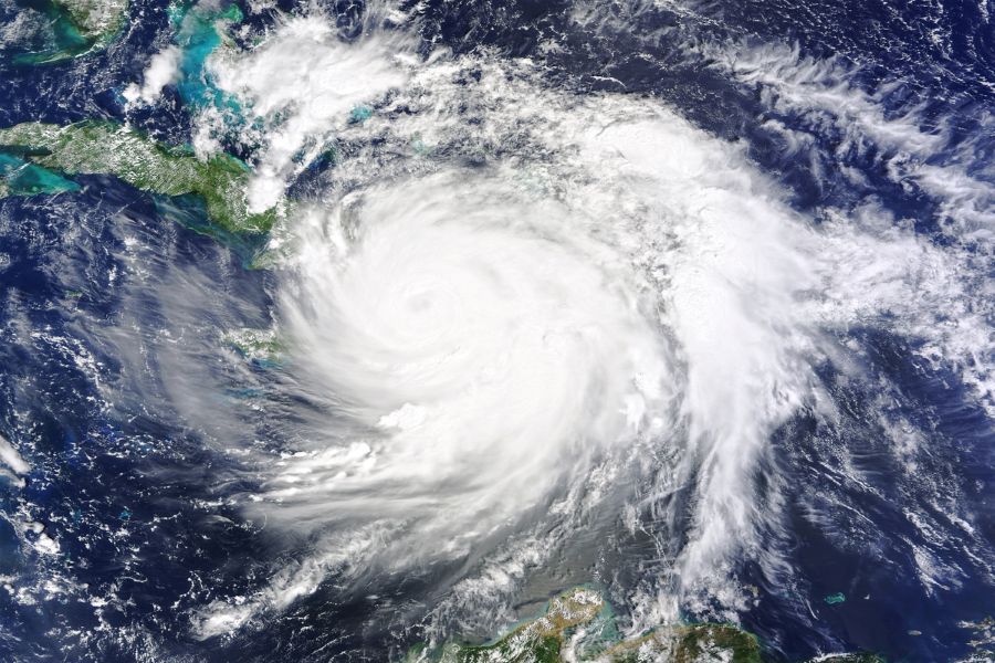
Forecasters expect Polo to remain offshore for now, but its enormous strength means coastal communities could still face dangerous conditions.
Flooding rain, damaging wind gusts and storm surge remain the biggest threats along portions of southwestern Mexico.
A track closer to the coastline would significantly increase the risk of more severe impacts.
“A broad area of 1-2 inches of rain is expected across parts of coastal southwestern Mexico,” Duffus said. “Rainfall totals of 4-8 inches are likely along the coasts of Guerrero, Jalisco, Colima and Michoacán, with an AccuWeather Local StormMax™ of 18 inches.”
Wind gusts of 40 to 80 mph are possible along parts of Guerrero, Jalisco, Colima and Michoacán, as well as southwestern Nayarit.
Localized gusts could approach 100 mph, while southern Baja California Sur could see gusts ranging from 40 to 60 mph.
Category 5 Hurricane Polo became the second-strongest hurricane ever recorded in the Eastern Pacific on Tuesday, with a pressure of 892 mb. Only Hurricane Patricia in 2015 was stronger, at 872 mb. pic.twitter.com/RwU16IAyaA
— AccuWeather (@accuweather) September 23, 2026
Puerto Vallarta and Cabo San Lucas are also expected to deal with dangerous surf, powerful wind gusts and periods of heavy rain as Polo moves through the region.
The hurricane is generating massive seas near its center, with waves estimated at 30 to 45 feet.
Those swells are expected to spread outward, creating hazardous conditions for small craft and anyone near exposed beaches.
Polo’s compact size and offshore track could limit the amount of storm surge reaching land, while the steep terrain along much of Mexico’s coastline may also reduce the extent of coastal flooding.
RELATED: Category 5 Hurricane Explodes In Pacific; Millions Of Americans Warned
Still, forecasters warned that the hurricane’s extreme strength could produce breakers of 15 to 20 feet along beaches with a more gradual slope.
Waves that large could cause serious overwash and coastal damage.
Polo may make several abrupt turns before settling into a more consistent northwest track later this week and into early next week.
That path would take the storm roughly parallel to Mexico‘s Pacific coast before a possible turn farther north later next week.
If that happens, tropical moisture from Polo could eventually reach parts of the southwestern United States.
Late-September moisture from the storm could feed into areas already dealing with an active North American monsoon, raising the possibility of more heavy showers and thunderstorms.
Forecasters are also watching for additional tropical development in the eastern Pacific in the coming weeks.
Any new storms could send more swells toward Southern California, increasing the risk of large waves, dangerous surf and coastal overwash from late September into early October.
Meanwhile, Tropical Depression 15-E is being monitored southeast of Hawaii and could bring torrential rain and flash flooding to the Big Island before spreading toward the central islands later this week.
POLL: Ilhan Omar Now Claims She’s Broke – Do You Believe Her?
