Politics
WATCH: Navy Releases Jaw-Dropping Footage From The Eye Of Catastrophic Hurricane Set To Make Landfall
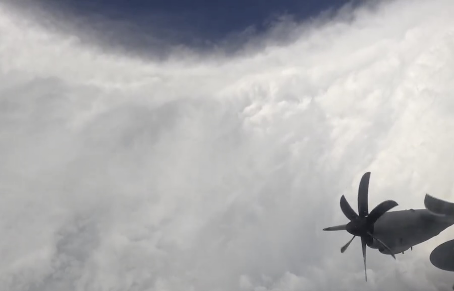
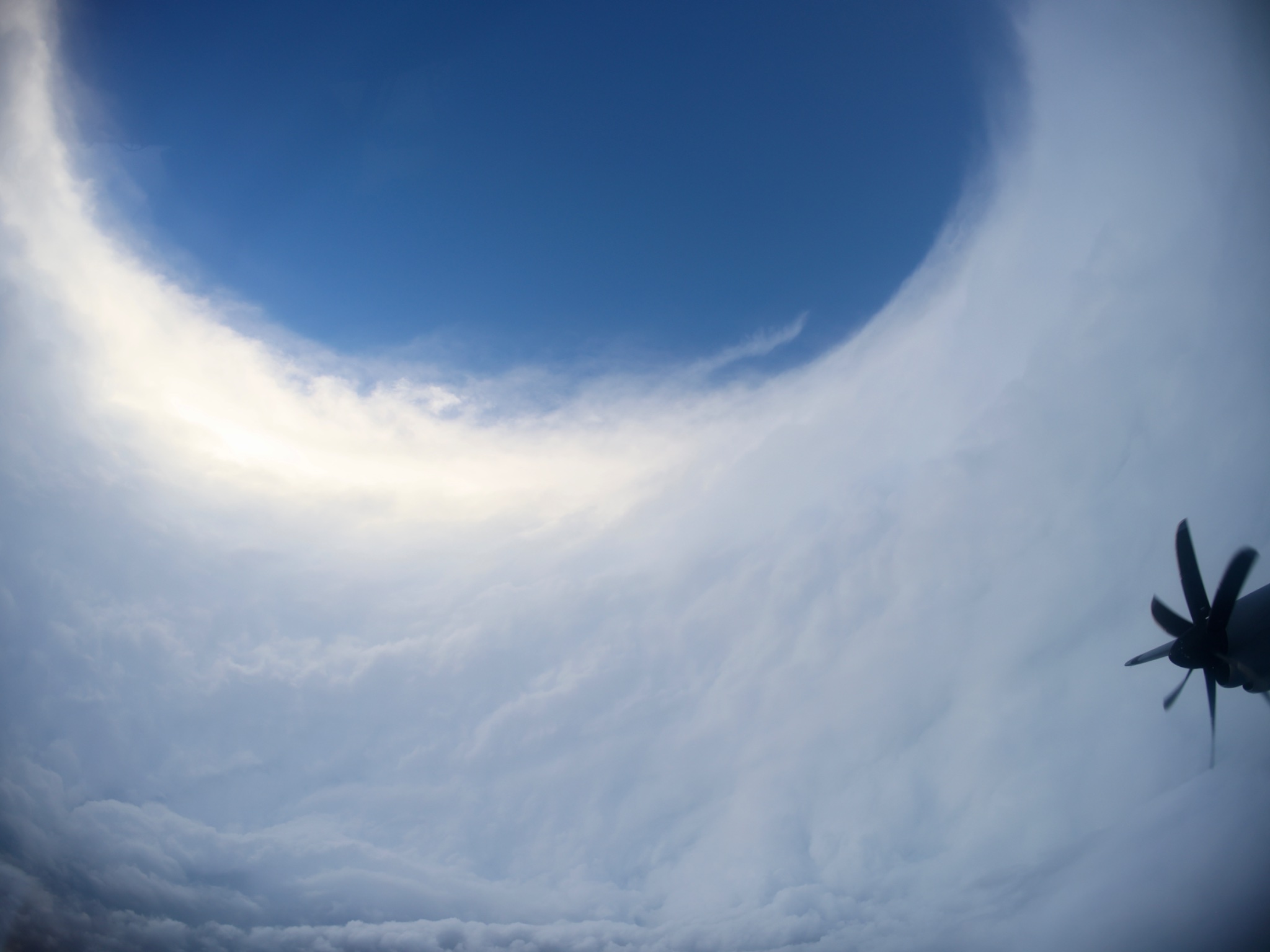
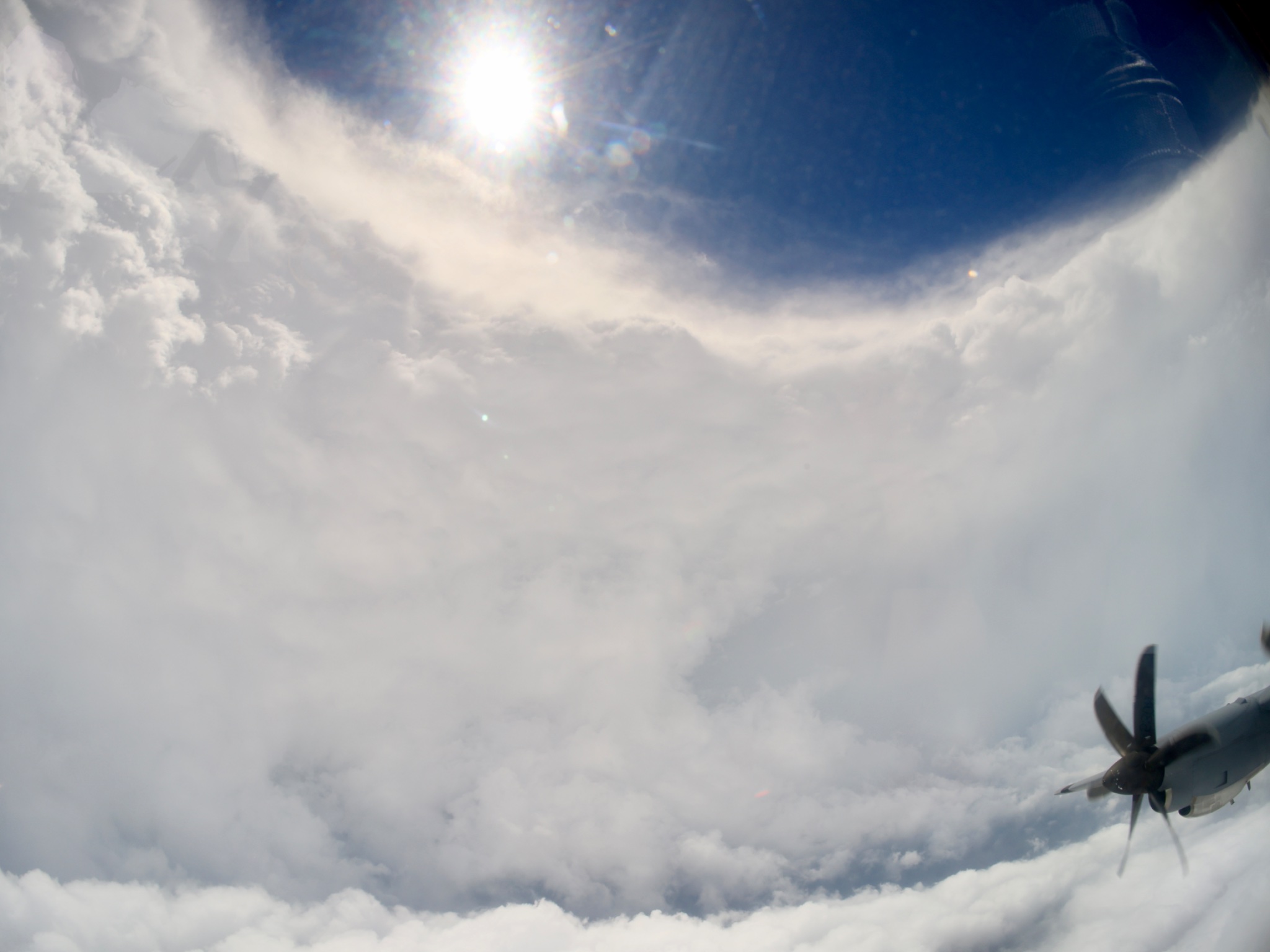
The U.S. Navy has released breathtaking new footage from inside the eye of Category 5 Hurricane Melissa, giving a rare—and terrifying—look at the raw power of nature just before the storm’s catastrophic landfall. The clip, captured aboard a reconnaissance aircraft flying directly into the hurricane’s core, showcases the now-viral “stadium effect”—a towering, symmetrical ring of clouds encircling a stunningly calm, eerily lit eye.
The video, taken by storm chaser and meteorologist Tropical Cowboy of Danger, documents the third pass through Melissa’s eye early Tuesday. “GoPro in side window as different camera looking forward shooting in ultra high res 8K,” he wrote on X. “Not sure when that might get processed as the file turned out ridiculous.”
What the footage captures is extraordinary: towering walls of cloud that appear like a circular coliseum rising into the stratosphere, illuminated by flashes of lightning and the first hints of sunlight piercing through the center. Even hardened hurricane experts have described the visuals as some of the most detailed imagery ever recorded inside a Category 5 storm.
WATCH:
Third pass through Melissa. GoPro in side window as different camera looking forward shooting in ultra high res 8k. Not sure when that might get processed as the file turned out ridiculous. Barely had HD space for it and MacBook Pro promptly chocked when I tried to edit it pic.twitter.com/3p430gPvZv
— Tropical Cowboy of Danger (@FlynonymousWX) October 27, 2025
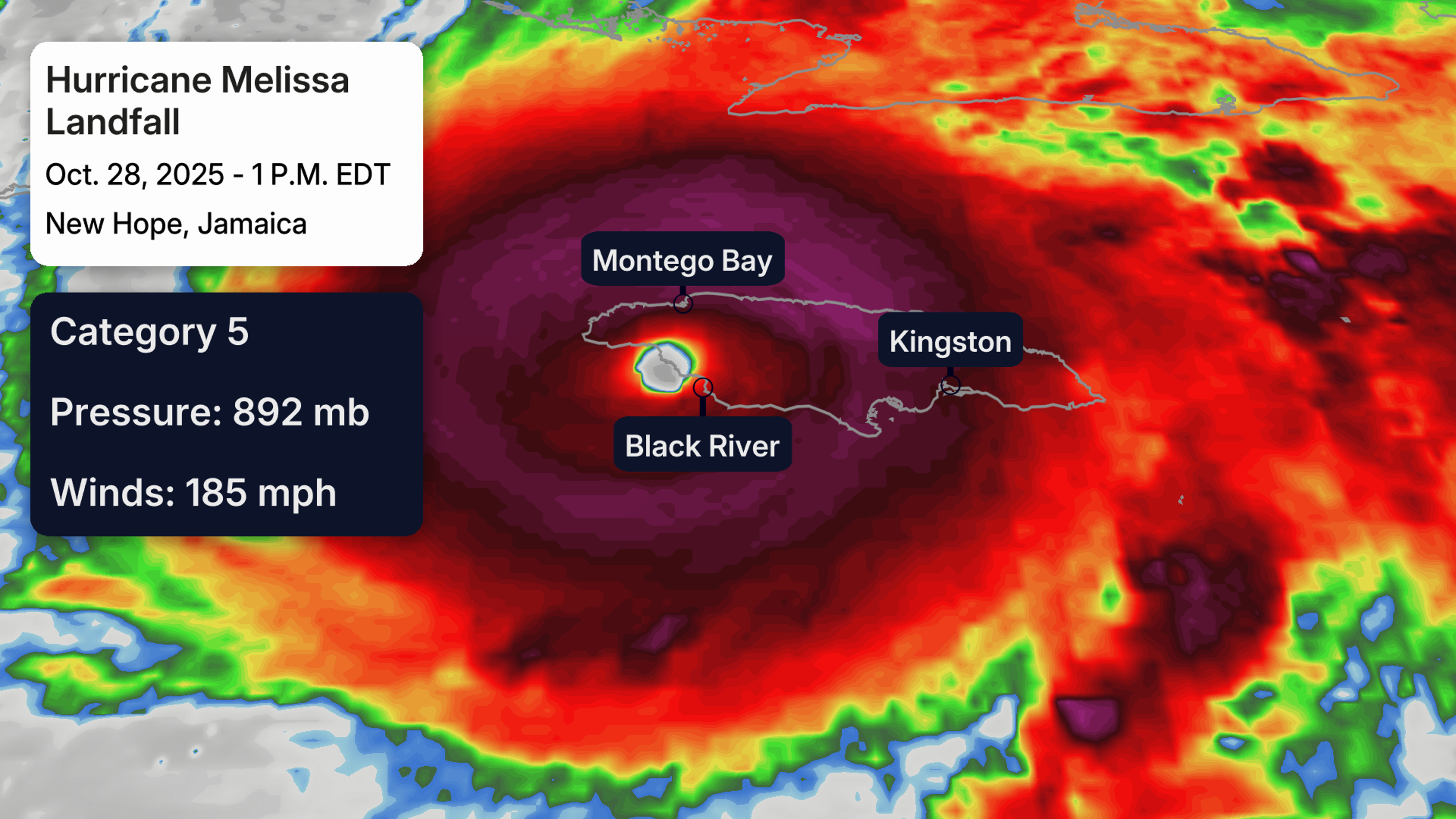
According to the National Hurricane Center (NHC), Hurricane Melissa made landfall in Jamaica on Tuesday, as an “extremely dangerous” Category 5 system with sustained winds of 185 mph and gusts topping 200 mph. The storm’s central pressure plummeted into the upper 800s millibar range, placing Melissa among the most intense Atlantic hurricanes ever observed.
NHC forecasters urged residents not to leave shelter during the storm’s eye, warning that “winds will rapidly intensify on the far side” as the eyewall passes. The hurricane’s slow crawl—just 3 mph forward speed—has worsened the destruction, prolonging exposure to relentless winds and torrential rain.
Melissa’s combination of strength, size, and sluggish motion is proving catastrophic. Reports suggest rainfall totals of 30 to 40 inches in some parts of the island, particularly near the Blue Mountains, triggering landslides and devastating floods. Jamaica’s steep terrain and recent deforestation have only amplified the danger.
Evacuation orders were issued across the island ahead of landfall, but officials fear many residents remained in vulnerable coastal communities. The government activated its national disaster response, deploying rescue teams and emergency shelters as communication lines went down across several parishes.
Meteorologists warn that Melissa isn’t done. Forecasts show the core of the storm moving toward eastern Cuba next, followed by the Bahamas and Turks and Caicos, with dangerous conditions likely persisting through the week. Cuba began mass evacuations over the weekend, while Haiti and the Dominican Republic are already experiencing flooding and tropical-storm-force winds.
via The Weather Channel
Satellite imagery shows Melissa’s wind field spanning nearly the length of Jamaica—a sign of its monstrous reach. As of late Tuesday, The Weather Channel described the storm as a “months-to-years recovery event,” noting that early structural assessments across Jamaica reveal widespread damage to homes, power grids, and transportation networks.