
Weather
NEW: Hurricane Isaias Takes Terrifying Turn As Millions Of Americans Brace For Devastating Impacts
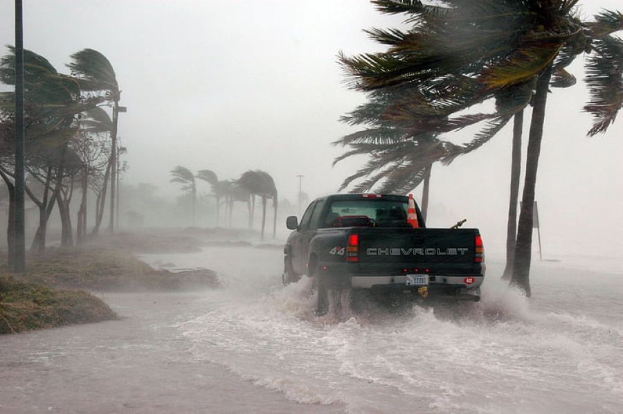
The powerful hurricane intensified Friday morning, packing sustained winds of 120 mph as it barreled toward the Florida Panhandle, Alabama and Mississippi.
The National Hurricane Center confirmed the alarming development after receiving fresh reconnaissance data from an Air Force Reserve aircraft flying directly into the storm.
‘Just-received data from an Air Force Reserve Hurricane Hunter aircraft indicate that Isaias has strengthened to a major hurricane with maximum sustained winds of 120 mph.’
With landfall expected late Friday, authorities have issued hurricane warnings across portions of Florida, Alabama and Mississippi, while coastal Louisiana remains under tropical storm and storm surge warnings.
Mandatory evacuations have been ordered in vulnerable coastal communities as residents scramble to protect their homes and businesses before conditions deteriorate.
The storm’s projected path places the greatest danger along the northern Gulf Coast, with forecasters expecting Isaias to make landfall somewhere between coastal Mississippi and the Florida Panhandle.
#Isaias has strengthened into a major Category 3 hurricane. Infrared imagery from @NOAA’s #GOESEast (#GOES19) 🛰️ is tracking Isaias as it approaches the northern Gulf Coast, where dangerous conditions are expected—including hurricane-force winds, life-threatening storm surge, flash flooding and possible tornadoes.
Latest updates on #HurricaneIsaias:
https://t.co/fqKRoZGXF9— NOAA Satellites (@NOAASatellites) October 9, 2026
As of Friday morning, the hurricane was positioned approximately 240 miles south of Pensacola, Florida, moving north-northeast toward the coastline.
Forecasters anticipate the storm could weaken to Category 2 strength before making landfall, but officials warn that even a weaker hurricane could unleash devastating destruction.
One of the most alarming threats is storm surge, with water levels potentially climbing 6 to 9 feet above normally dry ground between the Alabama-Florida border and Grayton Beach, Florida.
RELATED: NEW: Hurricane Isaias Rapidly Intensifies; Millions Of Americans Brace For Impact
Coastal Mississippi, Louisiana and Mobile Bay could experience flooding between 3 and 5 feet, threatening homes, roads and businesses near the shoreline.
Meanwhile, residents across southern Alabama, the Florida Panhandle and southwestern Georgia are bracing for widespread rainfall totals of 4 to 8 inches.
Some communities could receive a staggering 15 inches, raising fears of flash flooding, overflowing rivers and dangerous road conditions.
The threat won’t end at the coastline.
Forecasters warn that tornadoes could develop across coastal Alabama, the Florida Panhandle and southwestern Georgia beginning Friday afternoon, with the danger expanding into Georgia and the Carolinas on Saturday.
RELATED: State Of Emergency Issued As ‘Dangerous Hurricane’ Nears Landfall In US States
Meteorologist Matt Devitt delivered a blunt warning to residents still preparing for the approaching hurricane.
‘Hurricane preps need to be completed this morning. If told to evacuate, please do so.’
Images from the region show residents stocking up on emergency supplies, filling sandbags and boarding up properties as grocery store shelves begin emptying.
Public flight-tracking data also reportedly showed U.S. Navy aircraft departing the Gulf Coast ahead of the storm’s arrival.
Isaias has already made history, becoming the first hurricane of the 2026 Atlantic season unusually late in the year.
The storm’s rapid intensification has only heightened concerns about the destruction it could leave behind.
POLL: Should Barack And Michelle Obama Stay Out Of Politics?
